Discover Korea’s Dulle Trails with the Durunubi App
Did you know that you can hike the entire perimeter of South Korea? For the past two years, I’ve had the privilege and the pleasure of walking the Haeparang Dulle Trail on the east cost of South Korea with the Korea Tourism Organization through the 2024 Korea Dulle Trail Expedition and the 2025 Korea Dulle Trail Expedition, while tracking my travels through the Durunubi app.
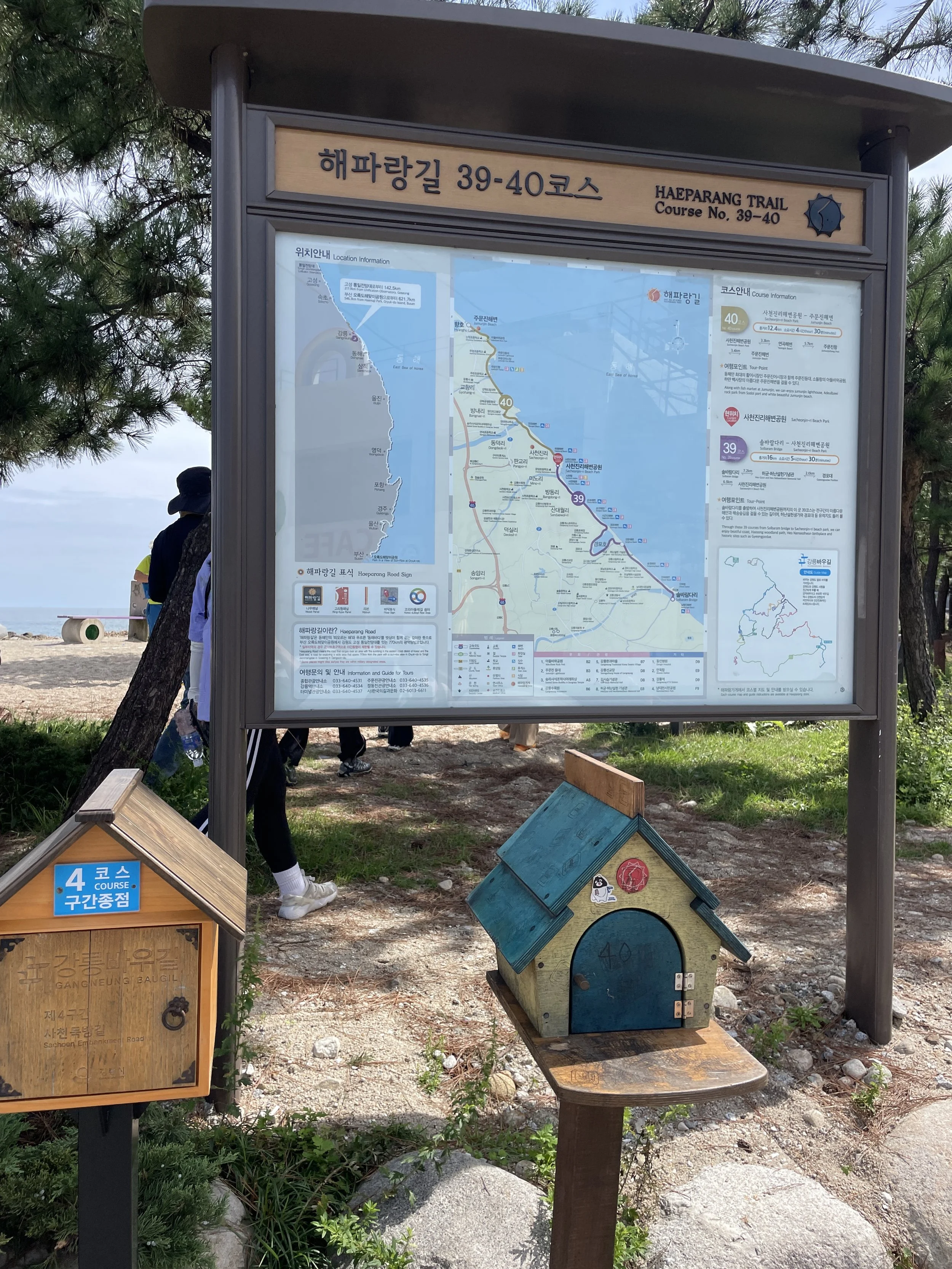
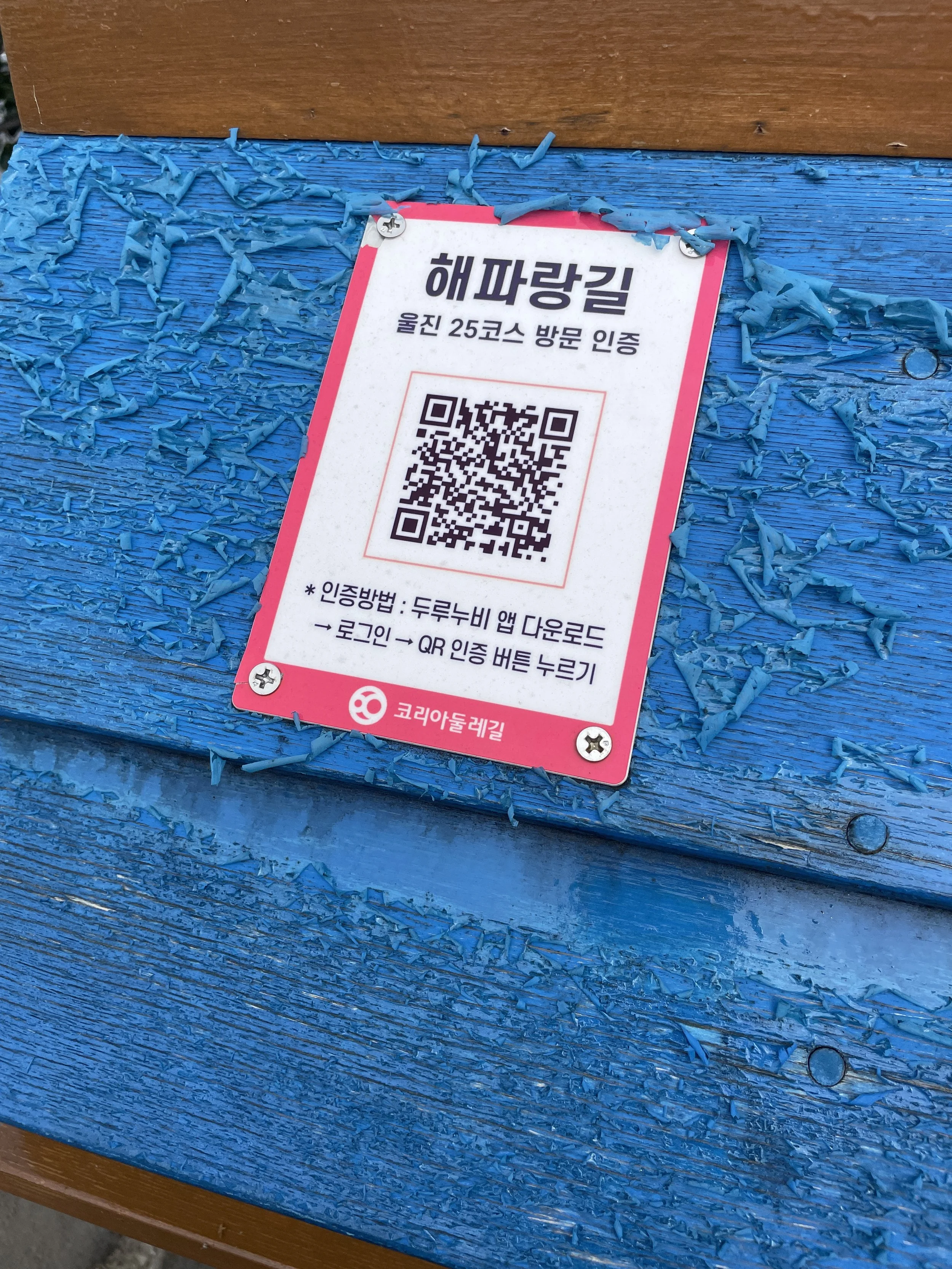
Haeparang Dulle Trail information board and stamp houses
If you’re living in or visiting South Korea and love exploring on foot, the Durunubi app (두루누비) is about to become your new best friend! Developed by the Korea Tourism Organization (KTO), Durunubi is designed to help you find scenic routes all over the country — from coastal boardwalks to countryside forest paths.
What Is Durunubi?

Look for this image to download the Durunubi app!
Durunubi is Korea’s official dulle trail-finding app, kind of like AllTrails, but focused entirely on South Korea. It highlights the 4 major national routes: the DMZ Peace Trail along the northern border, the Haeparang Trail following the east coast, the Namparang Trail along the southern coast, and the Seohaerang Trail along the west coast of South Korea.
Each listing includes maps, elevation data, photos, nearby attractions, and distance details — so you can plan everything from a one-hour stroll to a multi-day hike. You can view trail information such as the suggested length of time for walking each trail, the difficulty level and the length of each course.
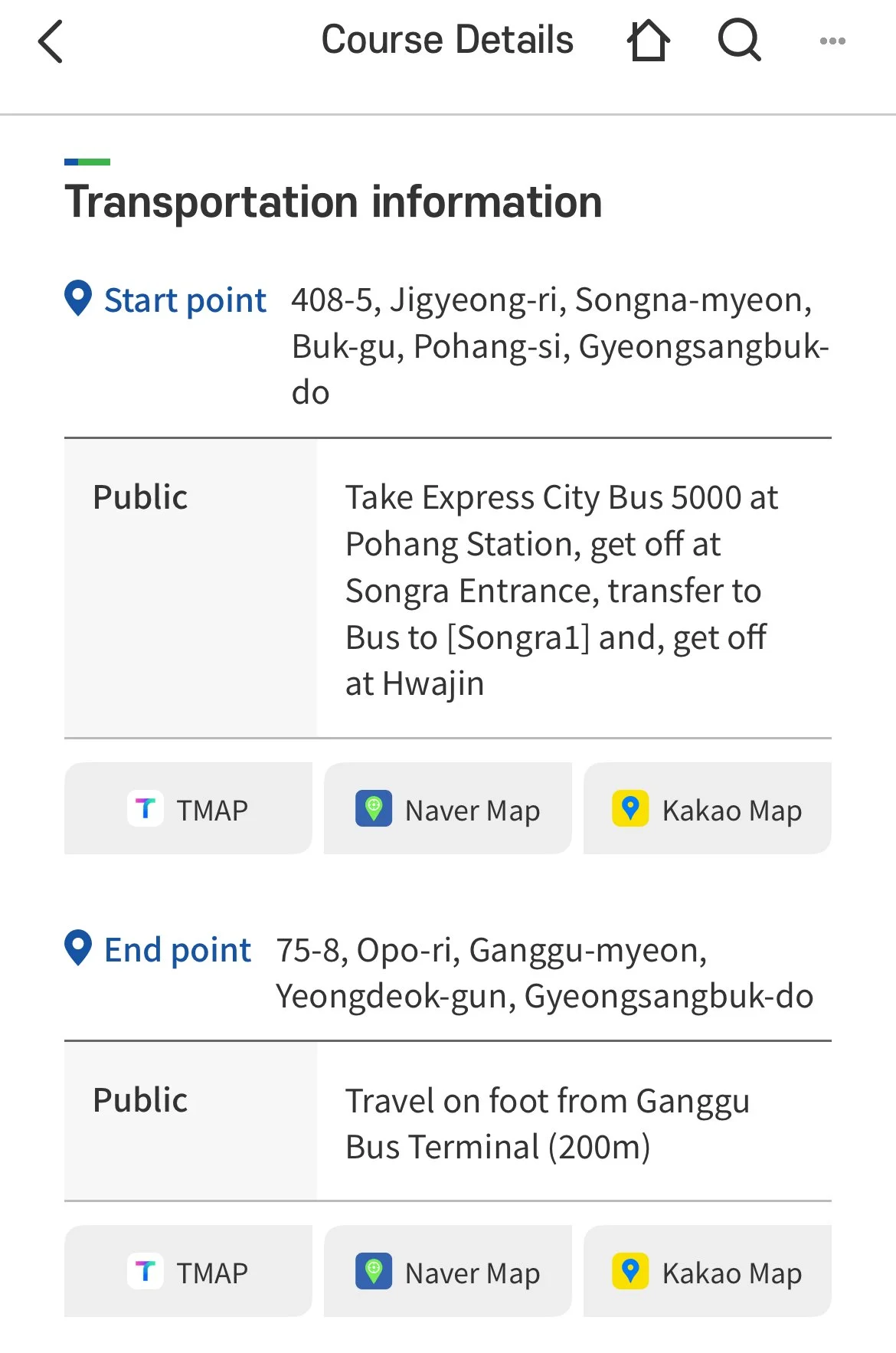
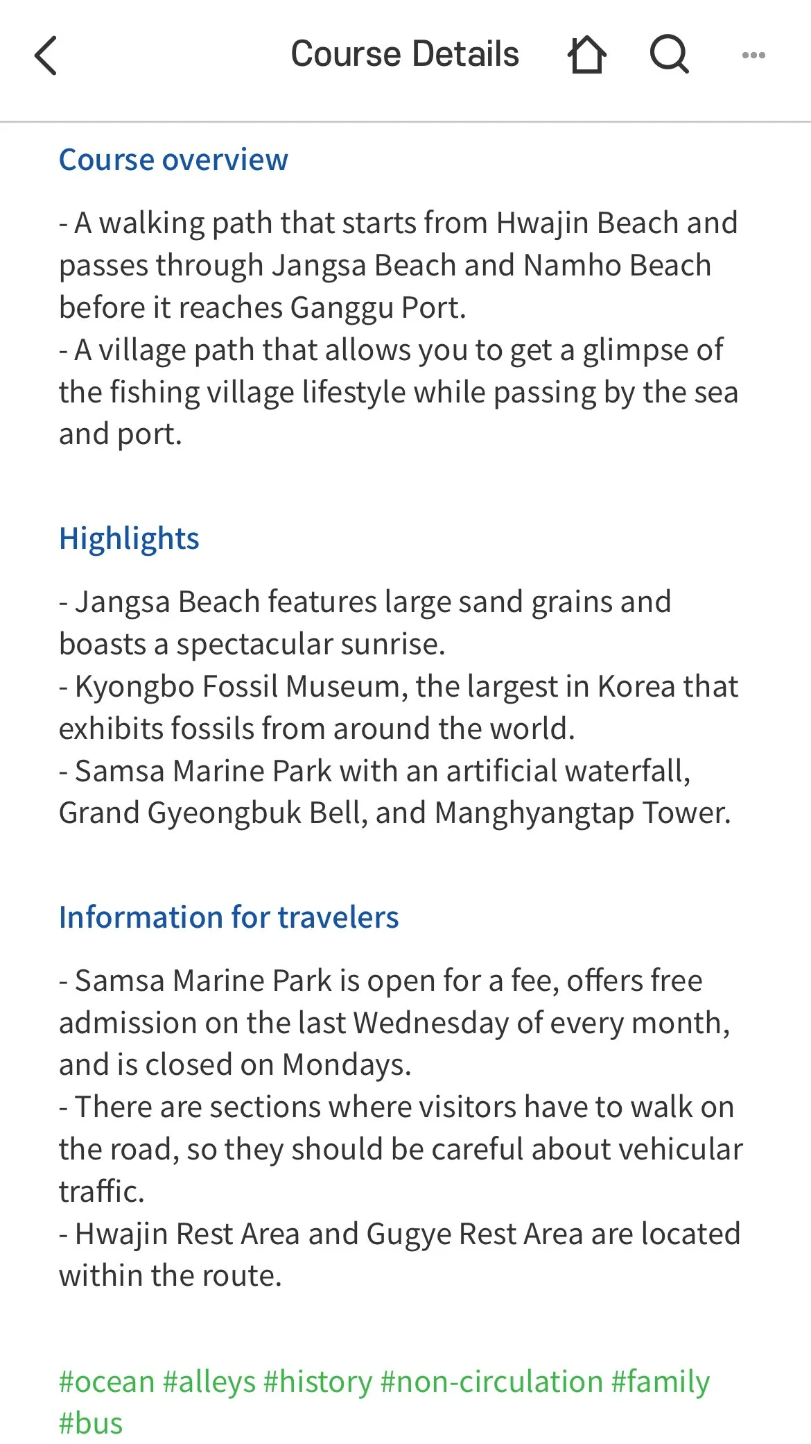

It also includes transportation information such as where the trail head starts or what bus will get you closest to the trail. Lodging information like which hotels or camp grounds are nearby as well as food information such as when an area lacks any conveniences and food and beverage should be packed for the day.
Why Travelers Love It
The app makes it easy to discover trails near your location and provides detailed route maps, elevation information, and photos. Many trails include cultural sites, rest stops, bathrooms and nearby attractions, so you can turn a simple walk into a full day of exploring.
Easy to use: The app works in English and Korean (though some trail descriptions may still be in Korean)
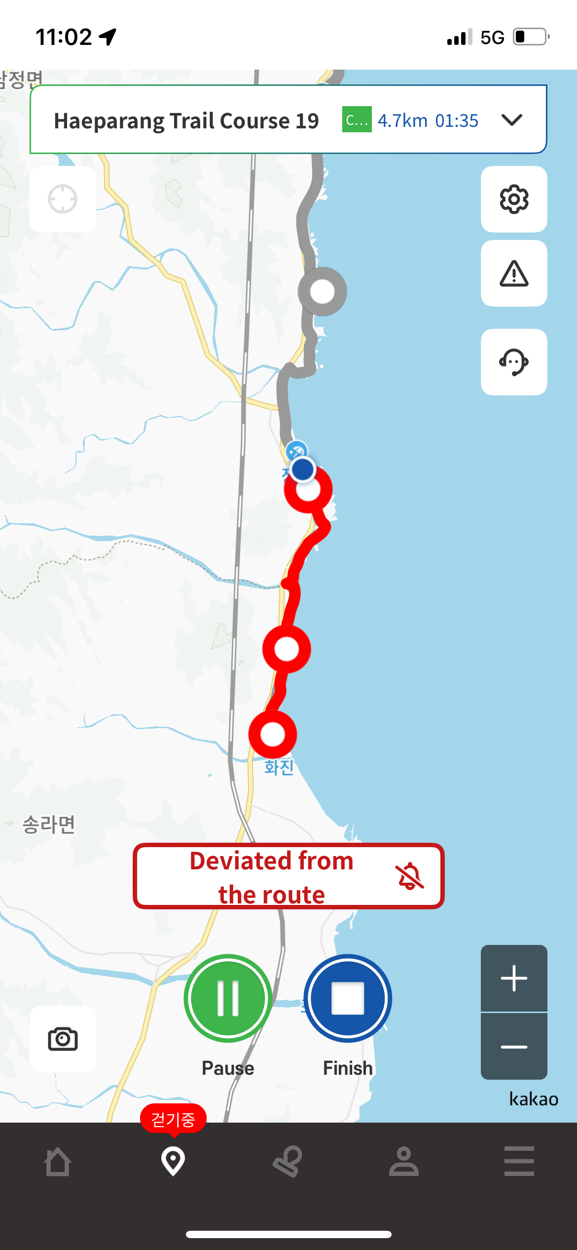
GPS tracking: Follow your progress in real time, even in rural areas.
Offline maps: Preload routes if you’re heading somewhere with spotty service.
Local insight: Many trails include cultural landmarks, cafes, and rest areas along the way.
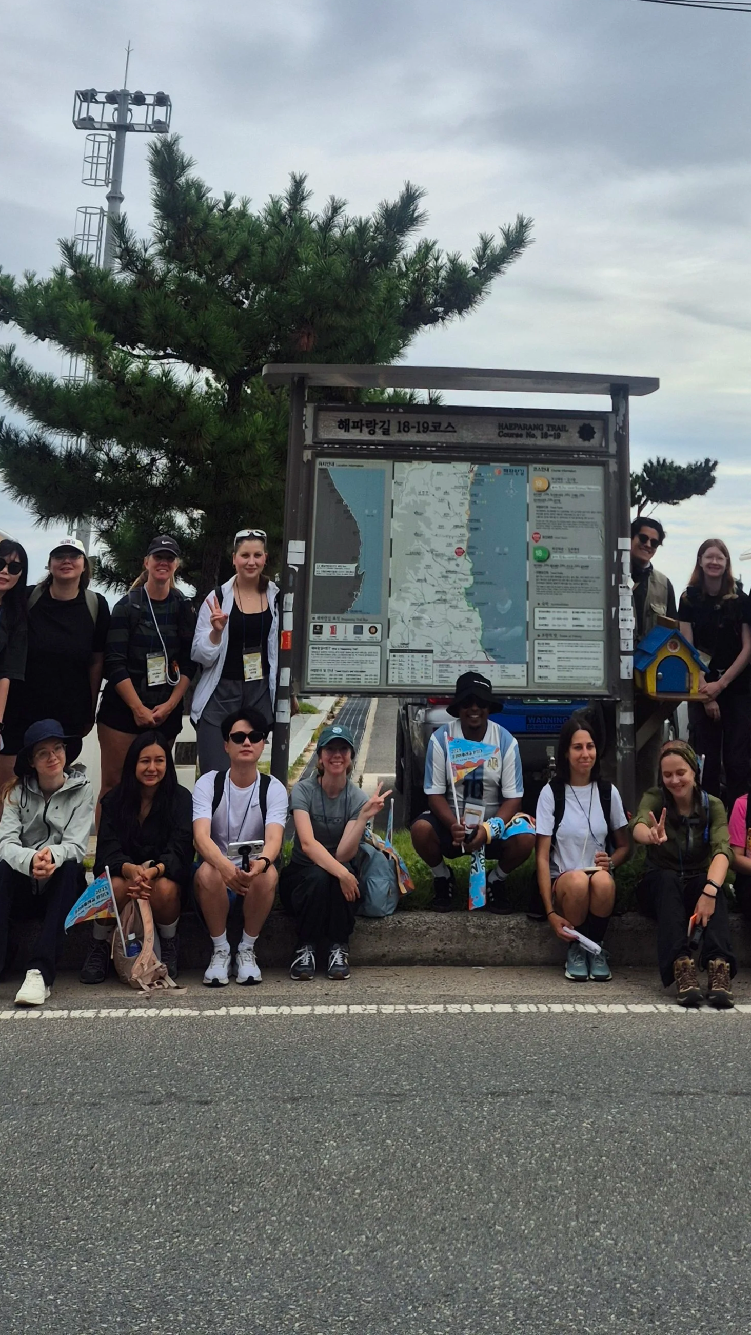
Exploring the Haeparang Trail — one of Korea’s most beautiful coastal walks, easily found on the Durunubi app.
Last year, the Durunubi app was tricky for foreigners to use — you needed a Korean phone number and an ARC (Alien Registration Card) registered in your name to track your progress. The good news? That’s been fixed! As of this year, you can download the app and start hiking right away, no extra setup needed! It’s an amazing tool for anyone who wants to see a more local, natural side of South Korea beyond the cities and sightseeing hotspots.
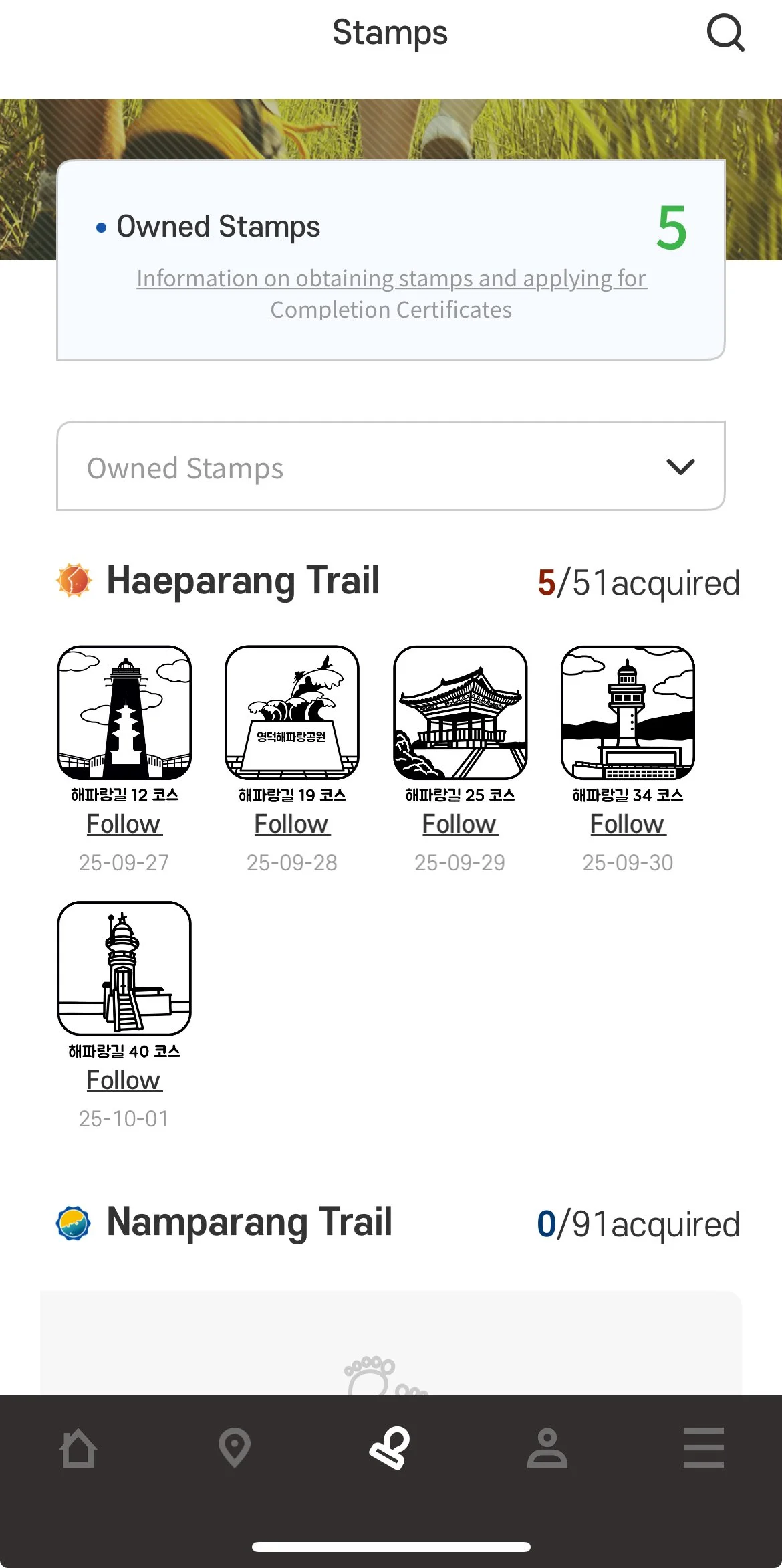
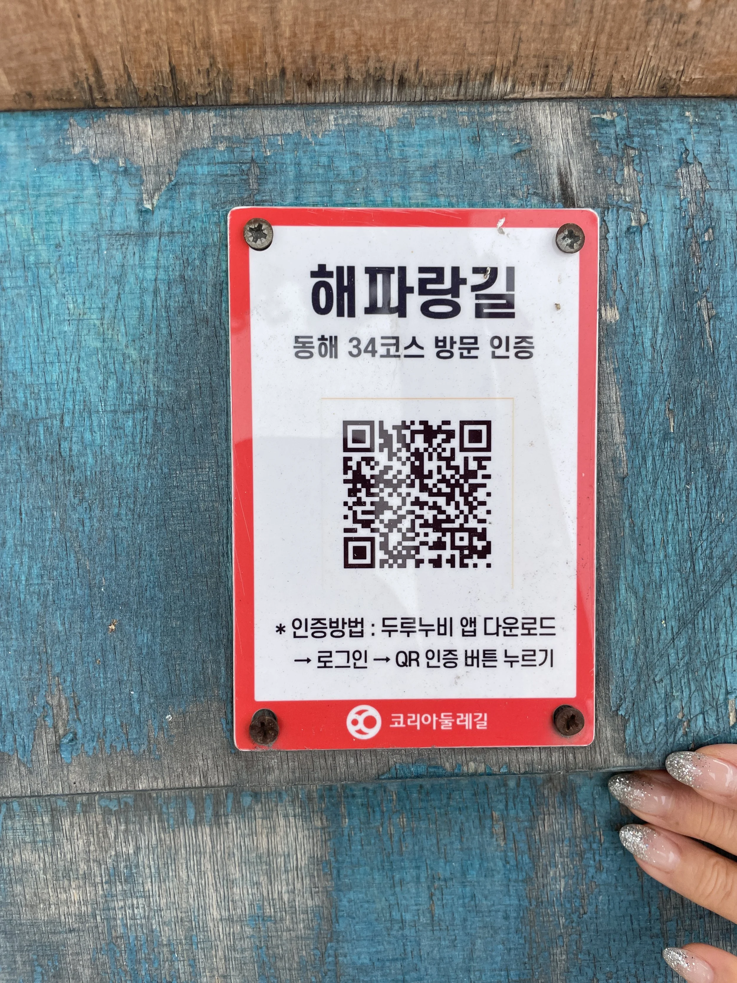
Durunubi stamps collected on the app
One especially fun feature along Korea’s Dulle Trails is the stamp collection system. At the beginning and end of each course, you’ll find small stamp houses where you can collect physical stamps in a notebook — a great souvenir for long-distance hikers. Even better, Durunubi allows you to collect stamps virtually as you reach certain checkpoints, so you can track your progress right from your phone.
Tips for Using Durunubi

Download ahead of time: Some remote areas have weak service, so preload your route before you go.
Switch to English: You can change the language in settings, though not all trail descriptions are fully translated.
Use GPS tracking: It’s super handy for staying on course when trails aren’t clearly marked. The app will very clearly announce that you’ve veered from the course.
Whether you’re a weekend walker or a long-distance hiker, the Durunubi app makes it easy to see Korea beyond the tourist spots.
📱 Durunubi is available for free on the App Store and Google Play. Download it today and start exploring!